Services
Laser Scanning
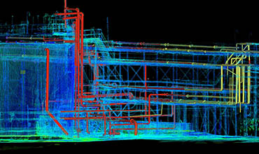
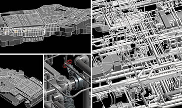
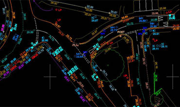
3D Laser Scanning combines controlled steering of laser beams with a laser rangefinder. By taking a distance measurement in every direction the scanner rapidly captures the surface shape of objects, buildings and landscapes. AstroGeo is a leading 3D Laser Scanning modelling service provider to multiple industries in a cost effective and timely manner. Our skilled and experienced resources have the capability to create intelligent and non-intelligent as-built models from industries like oil and gas, construction, etc.
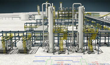
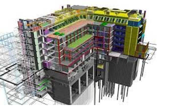
- BIM modelling (LOD100 to LOD500)
- 3D Model From 2D Drawings
- 2D/3D Plant Extraction & 2D Elevation
- MEP, HVAC, Architecture, Structure
- Design & Drafting Service
- 3D Modelling& Design
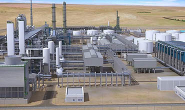
- Oil Plant Modelling
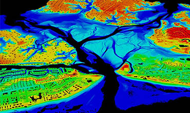
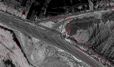
LiDAR
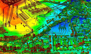
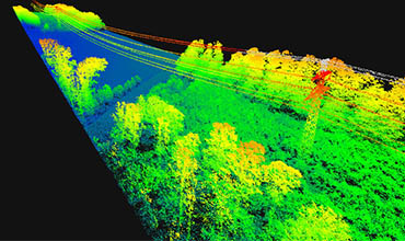
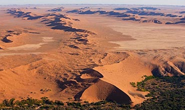
LiDAR (Light Detection and Ranging) is a revolutionary aerial laser scanning technology that enables height data from the land to be captured quicker, accurately and cost-effectively.
LiDAR is the most cost-effective method of capturing detailed height data both the ground and features on the ground. It is ideal for generating digital elevation models and contours. Mapping infrastructure such as power lines and corridors mapping for the proposed pipeline, railway and road routes.
Astro Geo Service provides a full range of LiDAR data processing services. We have experienced staff subjects to collect data to a rigorous quality control review process – including data density, terrain variation analysis, data anomaly filtering, review of 3D/perspective views and review against corresponding digital orthophotography (where available).
- DTM & DEM Extractions – Ground & Topographical classifications
- Power Line feature coding and catenary stringing
- Feature Extractions –Building, Moving features,Vegetation, etc.
- Contour generation
- Orthophoto generation using Terraphoto application
- Advance classification
- Power line classification
- DTM, DSM and Hydro flattening
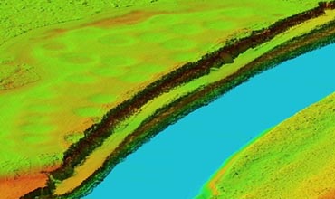
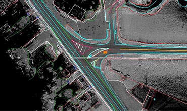
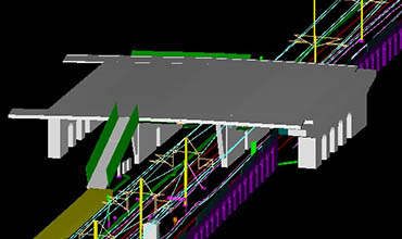
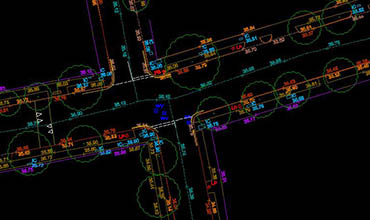
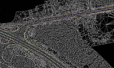
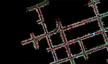
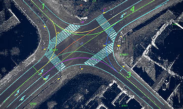
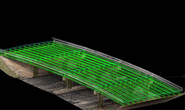
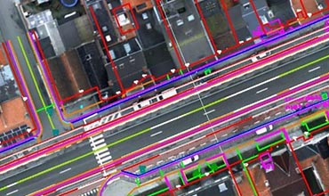
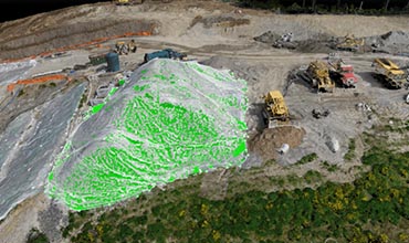
Mobile Mapping
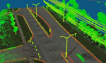
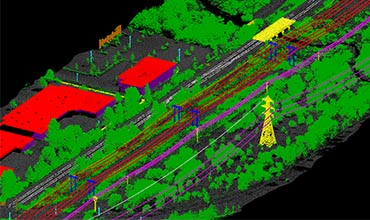
Mobile mapping is an innovative mapping system, using vehicle-mounted LiDAR sensors, cameras and position/navigation to collect survey quality point data.
At Astro Geo Service, we are specialized in providing mapping services to the transportation vertical which helps the industry capture complete as-built infrastructure for expansion planning and maintenance.
Railway corridor mapping and digitizing Railroad edges, Railway Platform, Break lines, Utilities, Signals, Power lines and Tunnels. Creating 3D Line Map for Road corridor from LiDAR Point Cloud data which included painted lines, Road edge, Kerb, Utilities, Signs and traffic signals to be mapped.
- 2D & 3D Mapping
- Railway corridor 3D Modelling
- Substation 3D Modelling
- Contour & Tin Generation
- Bridge Modelling
- Quarry modelling
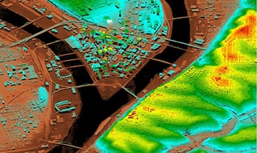
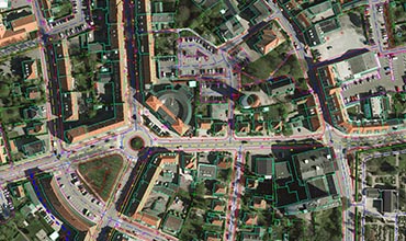
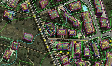
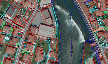
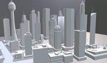
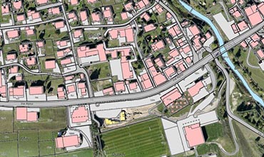
Photogrammetry
Astro Geo Service specializes in providing digital data from Aerial, 3D city models and Satellite imagery, typical scope of work includes Aerial Triangulation, creating DTM/DSM and digitization of all Planimetry features along with Orthophotos and includes creating as-built 3D Model by digitizing 3D Buildings and ground surface features and delivering Solid 3D Model for smarter cities in the most cost-effective way. We deliver exceptional products at cost-effective prices and a quick turnaround time.
- Aerial triangulation
- Planimetry
- DTM & DSM
- Corridor Mapping
- Hydro & Forestry Mapping
- 3D Model (LOD1, LOD2 & LOD3)
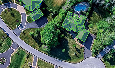
UAV Services
Drone aerial surveying has started to be widely used in the Geospatial sector. UAV images are used to generate high-quality DTM, DSM, contour, volumetric calculation and 3D modelling. Our UAV services include:
- Drone Survey
- Aerial triangulation
- Orthomosaic
- DEM Generation
- DTM Generation
- DSM Generation
- Contour generation
- UAV to photogrammetry
We Are One Of The Leading Geospatial Service Providers
Get in touch with us to discuss your requirements and get the most competitive quote for the best Geospatial services we desire to deliver to our clients.